When it comes to discovering and exploring ancient sites, drones are changing the game for archaeologists around the world. These small, unmanned aerial vehicles have the ability to capture stunning aerial views of sites that were previously impossible to see from the ground. Drones provide a unique perspective that allows researchers to uncover new insights into the mysteries of the past.
One of the most fascinating uses of drones in archaeology is the ability to capture detailed images of ancient sites from above. These aerial views provide a bird's-eye view of the landscape, allowing researchers to see patterns and structures that may not be visible from the ground. By flying drones over sites such as ancient ruins, burial grounds, and historic landmarks, archaeologists can gain a better understanding of the site's layout and significance.
With the use of drones, archaeologists can now create 3D maps and models of ancient sites, providing a new level of detail and accuracy to their research. These models can be used to study the site's architecture, plan excavation projects, and even simulate how the site may have looked in its prime. Drones are revolutionizing the field of archaeology by enabling researchers to explore ancient sites in ways that were previously unimaginable.
Mapping with Modern Technology
One of the most exciting developments in the field of archaeology in recent years is the use of drones for mapping ancient sites. These small, unmanned aerial vehicles are equipped with high-resolution cameras that can capture detailed images of archaeological sites from above. This has revolutionized the way archaeologists survey and map these sites, allowing them to create highly accurate 3D models of ancient structures and landscapes.
Before the advent of drones, archaeologists relied on ground-based survey methods that were time-consuming and often limited in scope. With drones, researchers can now cover large areas in a fraction of the time it would take using traditional methods. This has greatly increased the efficiency of archaeological fieldwork, allowing for more thorough and detailed mapping of ancient sites.
In addition to their speed and efficiency, drones also offer a unique perspective on archaeological sites. By capturing images from above, researchers can gain a bird's eye view of ancient structures and landscapes, revealing patterns and features that may not be visible from ground level. This new perspective has the potential to revolutionize our understanding of ancient civilizations and the way they interacted with their environments.
Aerial Insights into History
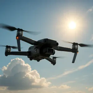
Have you ever imagined soaring above ancient ruins, seeing them from a perspective only birds can enjoy? Thanks to advances in technology, archaeologists are now able to uncover the mysteries of the past like never before. With the help of drones, these aerial vehicles equipped with high-resolution cameras, researchers are gaining unprecedented insights into history.
Drones provide a unique vantage point that allows archaeologists to survey large areas of land quickly and efficiently. By capturing detailed images from above, they can identify buried structures, ancient roads, and other features that are not visible from ground level. This innovative approach is transforming the field of archaeology, enabling experts to make new discoveries and reinterpret existing sites in ways previously thought impossible.
One of the key advantages of using drones in archaeology is their ability to access remote and inaccessible locations. From dense jungles to rugged mountainsides, drones can reach places that would be difficult or dangerous for humans to explore. This opens up a world of possibilities for researchers, enabling them to study sites that were previously off-limits due to logistical constraints. As a result, our understanding of ancient civilizations is expanding rapidly, shedding new light on their customs, beliefs, and daily lives.
Drones in Archaeology
Drones have completely transformed the way archaeologists explore and excavate ancient sites. These unmanned aerial vehicles provide researchers with a unique perspective from above, allowing them to capture detailed images and data that were previously impossible to obtain. By using drones, archaeologists can conduct surveys of large areas in a fraction of the time it would take using traditional methods, saving both time and resources.
One of the key benefits of using drones in archaeology is their ability to access hard-to-reach or dangerous areas. With their maneuverability and small size, drones can fly into tight spaces or over rugged terrain, capturing high-resolution images along the way. This has been particularly useful for exploring remote sites or areas that are off-limits to researchers due to safety concerns. By utilizing drones, archaeologists can gather valuable information without putting themselves at risk.
In addition to their usefulness in surveying and mapping, drones are also being used to create 3D models of archaeological sites. By taking multiple images from different angles, drones can create detailed and accurate 3D models that provide a better understanding of the layout and structure of a site. This technology has proven to be invaluable in studying complex archaeological sites, allowing researchers to analyze the data in ways that were previously impossible. As drones continue to evolve and improve, it is clear that they will play an increasingly important role in uncovering the mysteries of our ancient past.